RISCE

What is Satellite Crop Monitoring?
Satellite crop monitoring uses cameras and sensors in space to take pictures of farms and check how healthy the crops are. Farmers can see problems like dry soil or sick plants early, even from their phone or computer. This helps them save water, use less chemicals, and grow better crops without wasting time or money.
Are you a farmer?
I'm a paragraph. Click here to add your own text and edit me. It's easy.

Satellite Crop Monitoring Key Benefits
-
Drone Quality, Zero Flight Costs
-
Field Tested Accuracy
-
Farmer Centric Approach
-
Smart Alerts
-
Proven Demand
-
Multi-Purpose Tool
What is our Uniqueness?
We bring you the precision of drone imagery through satellite technology—no flights needed, no extra costs, just consistent high-quality monitoring of your fields. What truly sets us apart is how we empower you: instead of just handing over data, we involve you in every decision, turning satellite insights into practical actions that make sense for your farm.
Supporting companies and Institutes
We have received letters of interst from


We Are very thankful to the institutes for their support . We are visioning a great success and exemplary scientific and entrepreneurial penetration in the agricultural world.
Letters Of Interest


- Scientific Background -
We do not show scientific outputs, rather health status of plants which is understandable for farmers.

Crop health map from AI model and associated probabilities
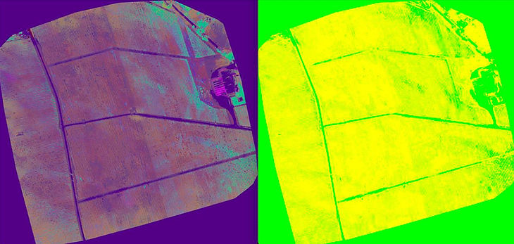
2020-8-25 Martin Berdugo
Healthy Crop
Moderate Crop
Stressed Crop
Dead Crop
Data-Driven Crop Health Alerts
